
The program has a walking element to it, starting with time spent in the Erongo Region your travels take you to Twyfelfontein area to view the rock art in the area. In the Palmwag area there is a two night stay, walking between camps on the Etendeka Concession, a great way to see the fauna, flora and geology of the area. From here our attention turns to the rich game viewing area in and surrounding Etosha National Park. This continues as we visit the AfriCat Foundation before heading back to Windhoek.
1 - 4 guests – Toyota Fortuner 4x4 / similar

If you are interested in booking this tour with us, please fill out the form below and we will get back to you.
Please make sure you filled out all the required fields marked with an *.
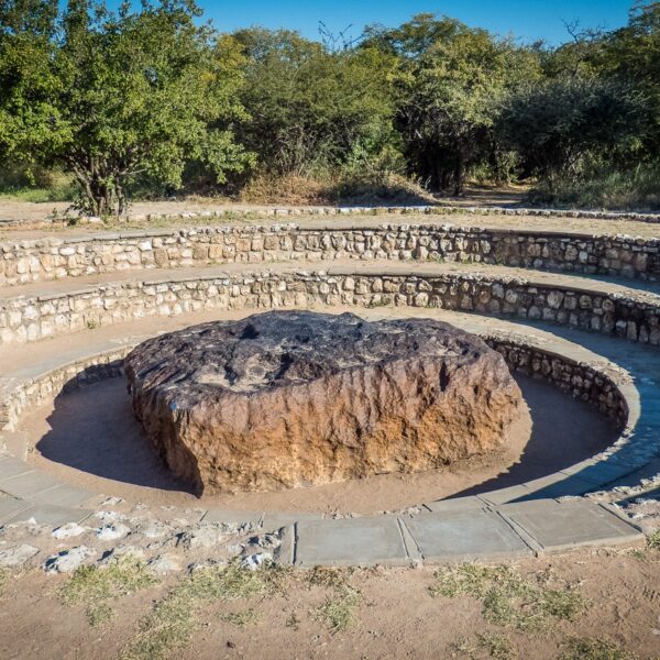
Otjozondjupa is part of the central regions in Namibia with various vegetation ranging from open savanna around Otjiwarongo Area, to lush vegetation which you can find in the main attraction area, Waterberg National park, and further north the Hoba meteorite close to the town of Grootfontein.
The Hoba meteorite near Grootfontein, is a National Monument in Namibia and popular among tourists reason being, that this is the largest piece of iron ever found near Earth’s surface, weighing 66tons.
Most of the Accommodation offered would be in the Waterberg Plateau area.
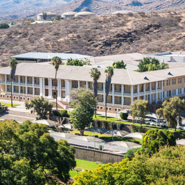
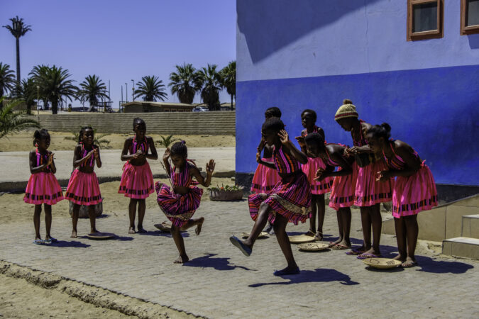
Windhoek, with its now over 500,000 inhabitants, is the largest city in Namibia. The pretty capital is located at an altitude of 1650 meters, in a basin of mountain ranges, lined by the Eros Mountains in the north and the Auas Mountains in the south. To the west, the Khomas Highlands stretch towards the Namib and the coast. The influence of the German language and culture can be seen in many areas due to the colonial past.
Particularly worth seeing are the “Ink Palace”, Namibia’s parliament building, the Christuskirche of the Lutheran community from 1896, the new bombastic Independence Museum right next to it and the “Alte Feste”, once the headquarters of the protection force and now the Namibian National Museum.

One of the most famous landmarks of Namibia is the Spitzkoppe rock massif consisting of granite rocks and belongs to the Erongo mountain region, which was formed more than 100 million years ago by volcanic activity and subsequent erosion. Magma penetrated upwards, but not to the surface. Due to wind erosion, the loose sand mass was subsequently eroded over millions of years until the granite intrusion was exposed.
You can hike extensively in this fascinating landscape and climb around among the bizarre rock formations. Also, this area is often visited by locals who are here in search of semi-precious stones. The Brandberg, located about 150 kilometers northeast of Henties Bay, is a granite massif, also formed by volcanic activity and subsequent erosion. The rough-looking and very dark-looking mountain covers an area of 760 square kilometers and towers over the surrounding land by about 2000 meters. The highest elevation is the Königstein, with 2573 meters and thus the highest mountain in Namibia

It extends south of the Kaokoveld to the skeleton coast to the west. This also includes the Grootberg and the Brandberg Massif as well as the northern foothills of the Große Randstufe. Driving through the area you will experience again and again stunning landscapes with bizarre mountains and wide stony plains. You rarely come across people and settlements. For this, there are still wild rhinos and desert elephants, mainly in the western part.
About 100 kilometers west of the city of Khorixas, you will find the main attractions declared by UNESCO World Cultural Heritage, prehistoric rock engravings. The engravings are located on smooth slabs of reddish sandstone and represent mainly animals or animal tracks. Also worth seeing is the Damara Living Museum near Twyfelfontein, an open-air museum that reflects the culture and traditional way of life of the Damara people.
The basalt columns, known as “organ pipes”, are up to 5 meters high and were created 120 million years ago. Lava penetrated the shale rock under high pressure and was later exposed by persistent erosion. The columns are located below the road along a ravine. The razor-sharp edges of the columns are unique. These should be handled with caution.
The “Petrified Forest” is located 40 kilometers west of Khorixas. Here you can find the fossilized remains of 280 million-year-old tree trunks. In 1950, the place was declared a national monument.
Further north you will find Fort Sesfontein. During the German colonial period, this was a base for protection against the predatory Swartbooi Namas. The First World War led to the abandonment of the station. The old fort was restored a few years ago and turned into a lodge. It is considered a gateway to the Kaokoveld.
Another highlight in Damaraland are the Ugab terraces and the 35 meter high Vingerklip rock dome.
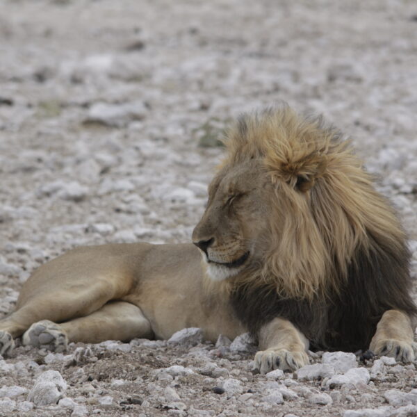
The Etosha National Park covers an area of over 22,000 square kilometers and was declared a wildlife sanctuary in 1907. In the center is an extensive salt pan, about 5,000 square kilometers in size, surrounded by grass savannas, light bushland in the west and dry forest in the northeast.
Gravel roads lead to the waterholes, where it is best to observe the game. There are three major state rest camps, Okaukuejo in the central part of the national Park, Namutoni in the east and the Halali Camp in between.
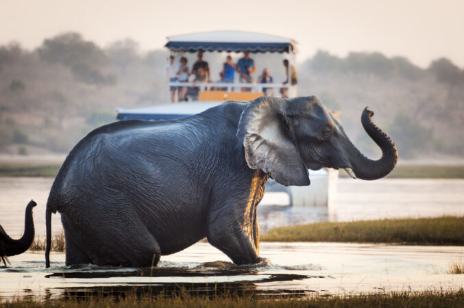
Almost the entire range of African game is represented in the park.
Etosha National Park is open all year round, every day from sunrise to sunset. At nightfall you have to be in one of the rest camps or leave the park beforehand.

A beguiling mixture of sophistication and relaxation, reminiscent of that ‘Out of Africa’ under canvas romance, Onguma Tented Camp is the ultimate in safari chic. Built i around an active waterhole and. Constructed from Etosha stone and triple-layered canvas tents on decks, the luxury tents are built in the tree-line, offering spacious interiors and uninterrupted views of the active waterhole.
Join our mailing list to get the latest news, updates and special offers delivered directly to your inbox.