
Travel through the Kalahari region of Namibia to the Fish River Canyon and on to the Aus and the ghost town of Kolmanskop. No visit to Namibia should be without a stay in the Namib Desert where a visit is made to Sossusvlei. Via Swakopmund to Damaraland with it’s wealth of rock engravings and desert adapted species. Further north we travel through Kaokoland, visit the nomadic Himba people and spend time in the tranquil setting of Epupa Falls on the Kunene River. Turning southward spend time on a private concession as well as within Etosha National Park where a wide variety of fauna and flora is to be seen. This wonderful journey through Namibia ends with a few nights at the Cheetah Conservation Fund.
1 - 4 guests – Toyota Fortuner 4x4 / similar
If you are interested in booking this tour with us, please fill out the form below and we will get back to you.
Please make sure you filled out all the required fields marked with an *.

Walvis Bay, is the area where most of tourist go when visiting Walvis Bay but definitely worth a visit. You can go for a boat cruise, see flamingos at the lagoon and they also have some good restaurants and little shops. Other than that, Walvis Bay is a port town, constantly busy with fishing boats and ships. Another highlight is the well know Dune 7, just outside of town. The Area is also known for the collection of guano and salt mining .
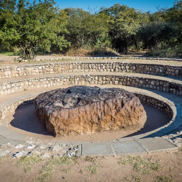
Otjozondjupa is part of the central regions in Namibia with various vegetation ranging from open savanna around Otjiwarongo Area, to lush vegetation which you can find in the main attraction area, Waterberg National park, and further north the Hoba meteorite close to the town of Grootfontein.
The Hoba meteorite near Grootfontein, is a National Monument in Namibia and popular among tourists reason being, that this is the largest piece of iron ever found near Earth’s surface, weighing 66tons.
Most of the Accommodation offered would be in the Waterberg Plateau area.
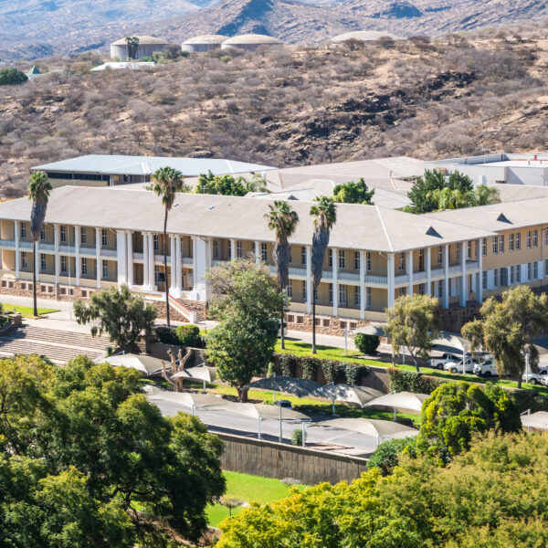
Windhoek, with its now over 500,000 inhabitants, is the largest city in Namibia. The pretty capital is located at an altitude of 1650 meters, in a basin of mountain ranges, lined by the Eros Mountains in the north and the Auas Mountains in the south. To the west, the Khomas Highlands stretch towards the Namib and the coast. The influence of the German language and culture can be seen in many areas due to the colonial past.
Particularly worth seeing are the “Ink Palace”, Namibia’s parliament building, the Christuskirche of the Lutheran community from 1896, the new bombastic Independence Museum right next to it and the “Alte Feste”, once the headquarters of the protection force and now the Namibian National Museum.
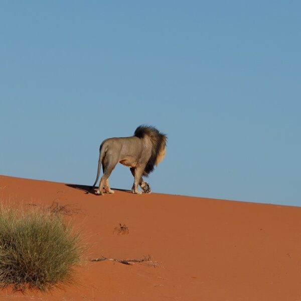
This huge desert area is part of the large inland basin in southern Africa. Because of its porous and sandy soil, which does not allow water resorption, the Kalahari is still called a desert, but in reality it is a wilderness filled with life, on whose grass-covered areas many herds of game and other animals live.
The Kalahari is the former main settlement area of the San. The San are organized in small families and live as nomadic hunter-gatherers. The family is fed by the rich wild stock of the Kalahari and the fruits and roots found here. They obtain water from water-storing plants
The annual amount of precipitation in the south and west is around 150-250 mm, while in the north and east it rises to over 500 mm, so the climate there is sub-humid. The Kalahari, except for this area, is located in a continental arid climate zone. It is characterized by long dry periods.

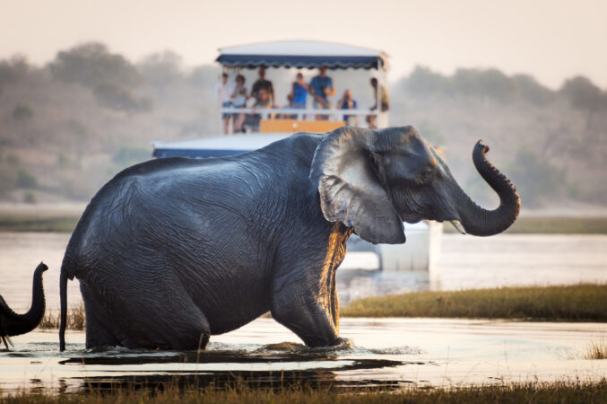
It extends south of the Kaokoveld to the skeleton coast to the west. This also includes the Grootberg and the Brandberg Massif as well as the northern foothills of the Große Randstufe. Driving through the area you will experience again and again stunning landscapes with bizarre mountains and wide stony plains. You rarely come across people and settlements. For this, there are still wild rhinos and desert elephants, mainly in the western part.
About 100 kilometers west of the city of Khorixas, you will find the main attractions declared by UNESCO World Cultural Heritage, prehistoric rock engravings. The engravings are located on smooth slabs of reddish sandstone and represent mainly animals or animal tracks. Also worth seeing is the Damara Living Museum near Twyfelfontein, an open-air museum that reflects the culture and traditional way of life of the Damara people.
The basalt columns, known as “organ pipes”, are up to 5 meters high and were created 120 million years ago. Lava penetrated the shale rock under high pressure and was later exposed by persistent erosion. The columns are located below the road along a ravine. The razor-sharp edges of the columns are unique. These should be handled with caution.
The “Petrified Forest” is located 40 kilometers west of Khorixas. Here you can find the fossilized remains of 280 million-year-old tree trunks. In 1950, the place was declared a national monument.
Further north you will find Fort Sesfontein. During the German colonial period, this was a base for protection against the predatory Swartbooi Namas. The First World War led to the abandonment of the station. The old fort was restored a few years ago and turned into a lodge. It is considered a gateway to the Kaokoveld.
Another highlight in Damaraland are the Ugab terraces and the 35 meter high Vingerklip rock dome.

Swakopmund was of great importance as a port during the German colonial period. Since the coastal waters are actually too shallow, a protected bay is missing and the surf is too strong, this attempt has failed.
Today Swakopmund is a popular holiday town for visitors offering many tourist attractions.
Swakopmund’s surrounding area also has a lot to offer. Particularly attractive are trips along the magnificent dune-lined coast, both to Walvis Bay, located 30 kilometers to the south, with its peaceful lagoon. The lagoon is a bird paradise. Especially impressive are the flamingos, which are usually very numerous near the shore looking for crayfish.
On a clear day, you can see the striking black and white lighthouse on the tip of the headland in the northwest of the lagoon.
In addition, sea salt is produced in Walvis Bay. 400,000 tons of high-quality salt are extracted annually on the 3,500 hectare salt fields
Dune 7
Sandboarding is permitted on the approximately 130-meter-high sand dune. Pure quadbike tours are also possible, one-hour or two-hour. Since it is easy to get lost in the almost endless dune world, quadbiking should only be done in the company of a guide.
Historic buildings
The beautiful historical buildings in Swakopmund – Hohenzollern House, Woermann House, Old District Court, Princess Rupprecht’s home, cable fair, “Knight’s Castle” – can be easily got to know during a stroll through the city.
Crystal Gallery Swakopmund
The Crystal Gallery in Swakopmund, on the corner of Tobias Hainyeko and Theo-Ben Gurirab Avenue, is definitely worth a visit. In modern designed rooms, the entire variety of ores and minerals to be found in Namibia is exhibited here, tourmalines, amethysts, aquamarines, dioptase, quartzes and much more. Particularly impressive is a giant quartz weighing 14 tons, the crystal is 3 meters wide and just as high, and the exposure took several years.
North of Swakopmund : Henties Bay, Cape Cross
A road leads directly along the beach to Henties Bay, and then to Cape Cross to the mouth of the Ugab River. This is where the Skeleton Coast National Park begins
Henties Bay is a fishing paradise and is fully dedicated to fishing tourism.
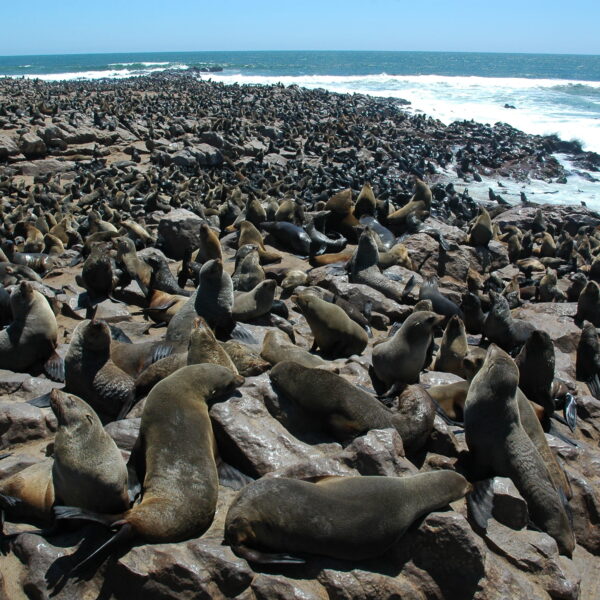
Cape Cross is a popular tourist destination, especially because of the nearby seal colony. At times, more than 100,000 dwarf fur seals, also called “eared seals”, gather here . You can get quite close to the animals via a wooden footbridge. The rather unpleasant stench is not for people with sensitive stomachs.
Cape Cross is part of the Dorob National Park, which was proclaimed in 2010. In the language of the Damara, Dorob means “water that sinks in the sand”.
Lüderitz and its surroundings
The small village of Aus is located about 125 kilometers east of Lüderitz. West of Aus begins the “Dune Namib”, and here you can mostly see a herd of wild horses
Garup was once a small railway station on the railway line from Aus to Lüderitz, completed in 1906. The small station house and the remains of the railway tracks as well as the water reservoir for the steam locomotive can still be visited today.
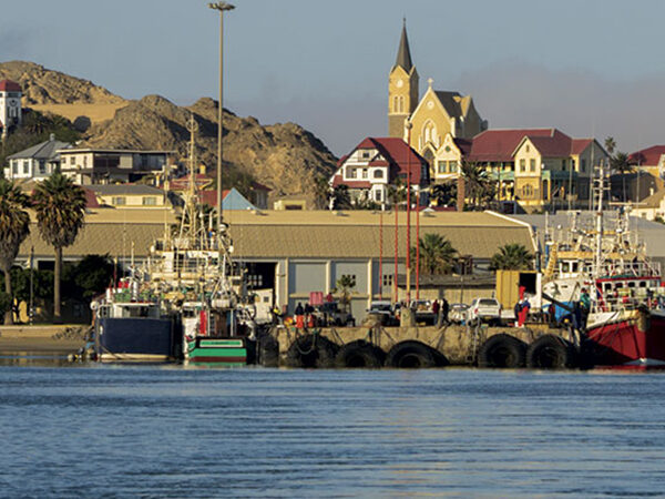
For the visitor, the nostalgic Lüderitz reveals itself as a very colorful small town, due to the numerous buildings originating from the German colonial period and lovingly maintained in the then popular Art Nouveau and Wilhelminian architectural style. The Evangelical Lutheran rock church from 1911 on the highest level of the city is striking, as well as the Goerke House with its bright blue roof and its grandiose sundial.A visit to the Lüderitz Museum is very worthwhile
Kolmanskop (Kolmanskuppe)
Of particular interest is the ghost town of Kolmanskop, once the center of the diamond industry in Namibia. Within two years after the first diamond was found, Kolmanskuppe was created. A complete place with a school, a first-class equipped hospital, an ice cream factory, a casino with a bowling alley, bakery, butcher and other facilities, as well as exclusive and pompous residential houses. Today this place is abandoned, and dunes have taken over the buildings and give the place a spooky atmosphere.
Big Bay
A trip around the lagoon and Sturmvogel Bay and Große Bucht to the Lüderitz Peninsula with Diaz Point is recommended. There is a small penguin colony on Halifax Island.
Shark Peninsula
The little trip to Shark Island, where the Lüderitz monument is also located, is worth it. From here you have a wonderful view of the Atlantic Ocean, the harbour entrance and the city
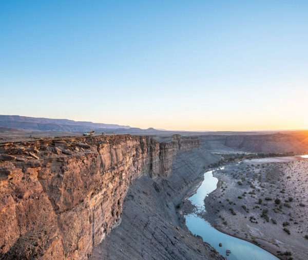
The Fish River is the second longest river in Namibia with somewhat 650 kilometers. It originates in the eastern Naukluft Mountains and flows southwest of Ai-Ais into the Oranje River. Since the Fish River is already dammed in Hardap near Mariental, it usually carries only small amounts of water with it. In winter, during the dry season, you often see no water at all or only individual puddles.
The hike through the Fish River Canyon may only be carried out between 1 May to 15 September, i.e. in winter. In summer temperatures are too extreme for hiking.
The deep gorge of the fish River is not only an event of severe erosion, but at the same time a consequence of flexures and breakup of the shallow Nama layers.
From the Fish River Canyon it is only a short jump to Ai-Ais at the southernmost end of the canyon. Hot thermal water gushes from the springs of Ai-Ais. It is around 60 ° C hot and rich in sulfates, chlorides and fluorides. ‘Ai-Ais’ means ‘burning water’ in the Nama language.
The Kaokoveld is very wild. Again and again you can see oryx antelopes, springboks, kudus or giraffes, mostly in the sandy dry rivers, in the shade of acacia trees. With a little luck you can also see the famous desert elephants.
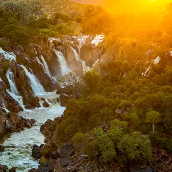
The capital of the Ovahimba, Opuwo, is located in the middle of the Kaokoland and offers shopping opportunities to the surrounding villages of the Normaden. Also, this area is a part of the Kunene region, where the Epupa Waterfalls, further east the Ruacana Falls are located, which fill only with good rainfall in the neighboring country of Angola.
The modest and semi-nomadic shepherd people, the Ovahimba, were able to largely preserve their ethnic identity and culture in the seclusion of the Kaokoland. The friendly people mainly breed cattle, fat–tailed sheep and goats, and – depending on the season – they move with their flocks to different, not dried-up watering places. Their small mud huts offer them a protective place to stay, because it can get very hot there.
Join our mailing list to get the latest news, updates and special offers delivered directly to your inbox.