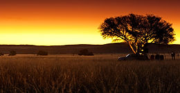
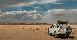
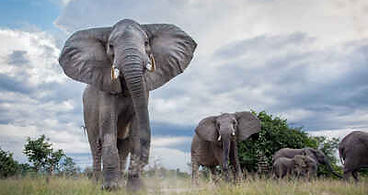
The Chobe National Park is the biggest in the Chobe/Kasane region. It is one of the largest parks in Botswana. Its landscape varies from floodplains, dense Mopane forests, and savanna to grasslands...
The “Ovamboland” , former homeland of the Ovambo north of the Etosha Pan, was divided into the 4 districts Omusati, Ohangwena, Oshana and Oshikoto after the independence of Namibia.13 k...
The quiver tree is one of the aloes that are often photographed at sunset. The “quiver tree forest” on the Gariganus Farm is best photographed in the late afternoon or at sunset. The fa...
It extends south of the Kaokoveld to the skeleton coast to the west. This also includes the Grootberg and the Brandberg Massif as well as the northern foothills of the Große Randstufe. Driving thro...
One of the most famous landmarks of Namibia is the Spitzkoppe rock massif consisting of granite rocks and belongs to the Erongo mountain region, which was formed more than 100 million years ago by ...
The Etosha National Park covers an area of over 22,000 square kilometers and was declared a wildlife sanctuary in 1907. In the center is an extensive salt pan, about 5,000 square kilometers in size...
The Fish River is the second longest river in Namibia with somewhat 650 kilometers. It originates in the eastern Naukluft Mountains and flows southwest of Ai-Ais into the Oranje River. Since the Fi...
Discover the captivating western region of Botswana, renowned for its thriving cattle farming industry. Not only is it a perfect pit stop for restocking your supplies while camping, but it also off...
This huge desert area is part of the large inland basin in southern Africa. Because of its porous and sandy soil, which does not allow water resorption, the Kalahari is still called a desert, but i...
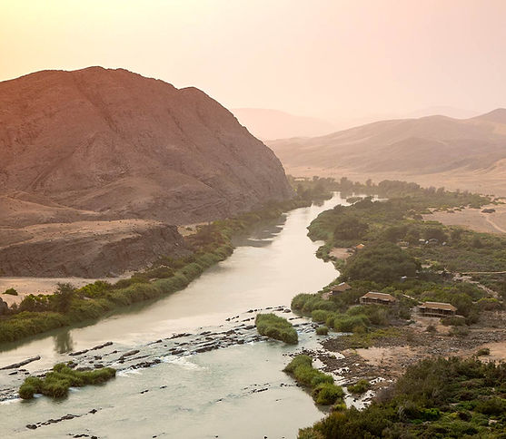
The Kaokoveld is very wild. Again and again you can see oryx antelopes, springboks, kudus or giraffes, mostly in the sandy dry rivers, in the shade of acacia trees. With a little luck you can also ...
The environment is becoming denser and greener, trees are becoming more numerous. Free-roaming goats, sheep and cattle move between the settlements, and fields with corn and millet, and unexpectedl...
Lüderitz and its surroundingsThe small village of Aus is located about 125 kilometers east of Lüderitz. West of Aus begins the “Dune Namib”, and here you can mostly see a herd of wild horsesGarup w...
The Namib-Naukluft Park is Namibia’s largest nature reserve with a total area of around 50,000 square kilometers. It comprises a belt about 100 to 150 kilometres wide along the Namibian coast...
North of Swakopmund : Henties Bay, Cape CrossA road leads directly along the beach to Henties Bay, and then to Cape Cross to the mouth of the Ugab River. This is where the Skeleton Coast National P...
The Panhandle region, situated beyond the protective barriers of the Delta ecosystem, offers a captivating array of wildlife and an abundance of avian species. Notably, one can encounter magnificen...
The Omaheke Region ( Hereo language: Sandveld) region lies on the eastern border of Namibia and comprises the district of Gobabis as well as former Hereroland East. A large part of this regio...
Tsumeb is located in the so-called “Otavi Triangle”, which refers to the area between the towns of Tsumeb, Otavi in the southwest and Grootfontein in the southeast. The Otavi Triangle r...
Otjozondjupa is part of the central regions in Namibia with various vegetation ranging from open savanna around Otjiwarongo Area, to lush vegetation which you can find in the main attraction area, ...
The Skeleton Coast Park covers an area of approx. 16 845 km² along the northern Westcoast of Namibia. It is know for its shipwrecks, its rescues and stories of brave survivors. Thick fog, strong wi...
The dunes in the Namib Desert were formed over the course of many millions of years. Sand,which was constantly washed into the sea by the Orange River, was transported northwards along the west coa...
The Capital of Namibia, Windhoek, is surrounded by mountain ranges and lives at an altitude of approx. 1700 above sea level. Hence there is no possibility of having an International Airport within ...
Swakopmund was of great importance as a port during the German colonial period. Since the coastal waters are actually too shallow, a protected bay is missing and the surf is too strong, this attemp...
Walvis Bay, is the area where most of tourist go when visiting Walvis Bay but definitely worth a visit. You can go for a boat cruise, see flamingos at the lagoon and they also have some good r...
The Waterberg Plateau, located 70 kilometers east of Otjiwarongo, rises about 200 meters from the surrounding sandy Kalahari Plain. The 20-kilometer-wide and 50-kilometer-long Table Mountain massif...
Windhoek, with its now over 500,000 inhabitants, is the largest city in Namibia. The pretty capital is located at an altitude of 1650 meters, in a basin of mountain ranges, lined by the Eros Mounta...
The former Caprivi Strip (today Zambezi region), is a bulge in the northeast of Namibia. Drawing the border and naming it after Leo von Caprivi, it dates back to the colonial prehistory of the coun...
The Scottish missionary David Livingstone identified the falls in 1855, and naming them Victoria Falls after Queen Victoria. Since the mid 20th century, the site is growing to be a very import...